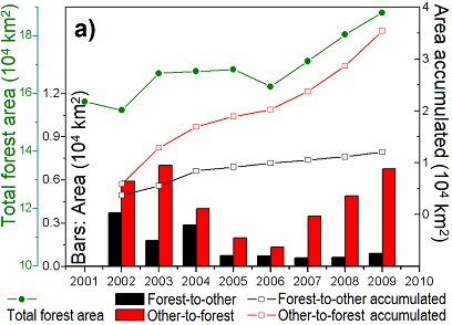
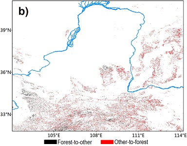
Remotely-sensed land use land cover data from MODIS (Moderate Resolution Imaging Spectroradiometer), LAI (leaf area index), and NDVI (Normalized Difference Vegetation Index) revealed increase in greeness and vegetation cover, including grassland and forests in the last decade (2000s) compared to the previous decade (1990s). This change agrees to the government census data, and is found to be the result of implementation of Grain for Green Project and other afforestation efforts.


| Observed data show that the change of forest coverage
has little
relationship with changes in precipitation and temperature, rather
reflects the human-induce increases in forest coverage. Change in the LAI (or NDVI) between the two decades suggests the impact from climate. Increased LAI implies vigorous growth of vegetation. However, so far it is not possible to distinguish climate- and human-induced changes from only the observations. Modeling will provide the possibility in answering this question. |
 |
